![]()
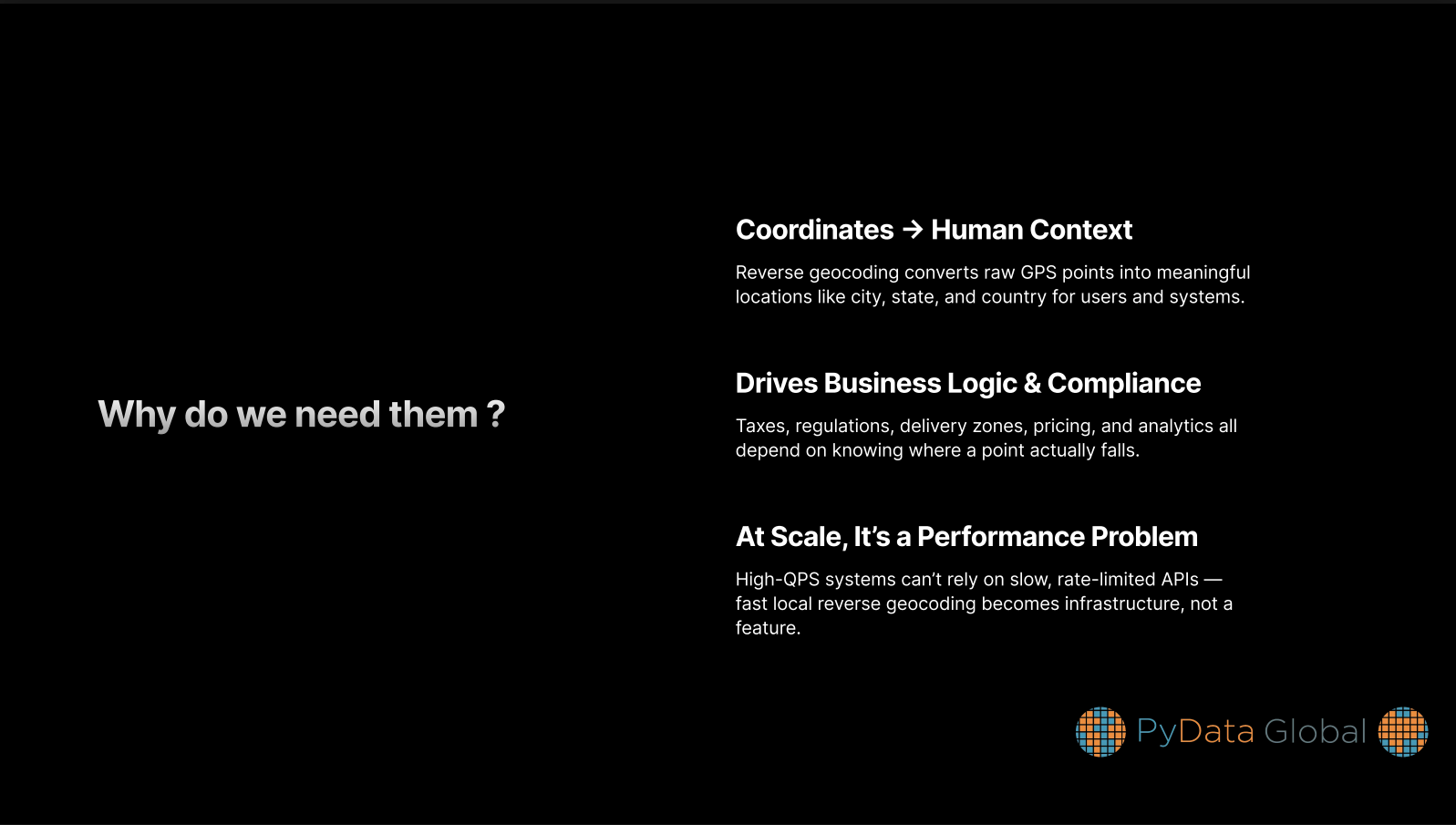
While commercial reverse geocoding APIs, such as Google Maps or Mapbox, are effective, they are also costly, have rate limitations, and are not appropriate for offline or privacy-sensitive settings.
Using available datasets and Python modules like cKDTree, shapely, and geopandas, we will demonstrate how to create a quick, scalable, offline-capable reverse geocoding system in Python in this session.
Reverse geocoding — converting coordinates into readable place names — is a core building block of applications in logistics, mapping, mobility, and location intelligence. Yet developers are often locked into commercial APIs that are expensive, rate-limited, and unsuitable for offline or privacy-first use cases.
In this talk, we’ll walk through the architecture and implementation of a fast reverse geocoding engine built entirely in Python using open-source tooling. You’ll see how spatial data (such as OpenStreetMap shapefiles) can be indexed efficiently using scipy’s cKDTree, queried with millisecond latency, and integrated into real-world systems.
We’ll explore performance trade-offs, data preprocessing techniques, and methods for dealing with ambiguous or noisy GPS data. The session includes benchmarks and a live walkthrough of the code powering the reverse geocoder — which is lightweight enough to run on a laptop or edge device.
Attendees will leave with a clear understanding of how to build and adapt this system for their own needs — and gain insight into how geospatial systems work behind the scenes.
You will learn how to:
- Convert geographic shapefiles into effective spatial indices
- Perform location lookups in milliseconds using tree search and vector mathematics
- Handle edge cases like unclear borders, cities with identical names, and GPS noise
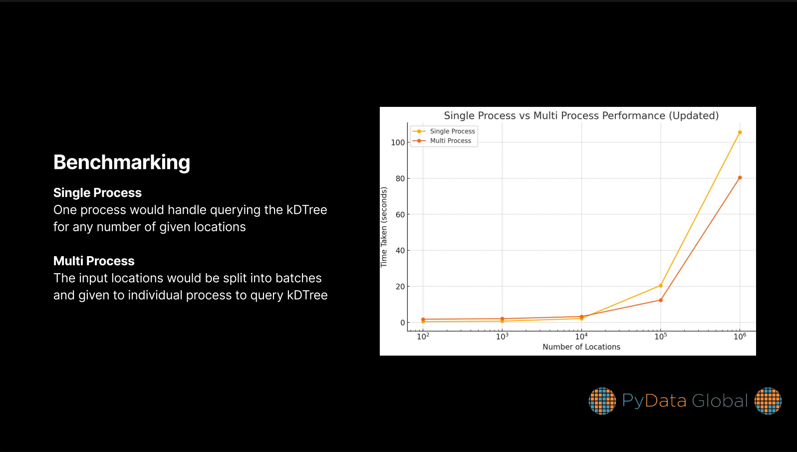
- Improve performance and memory usage through multiprocessing
- The system is fully open source and has been production-tested in a high-throughput environment. Whether you are developing applications for edge inference, mapping, or logistics, this talk will help you take control of your geospatial infrastructure without depending on costly commercial APIs.
Sooraj Sivadasan
Product Engineer at @ Strollby
- Contact:
Outline


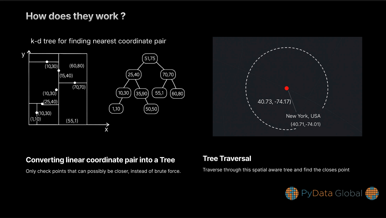
The kDTree was the data structure of my choice, due to their spatially oriented structure (You could see that in the slide 3)
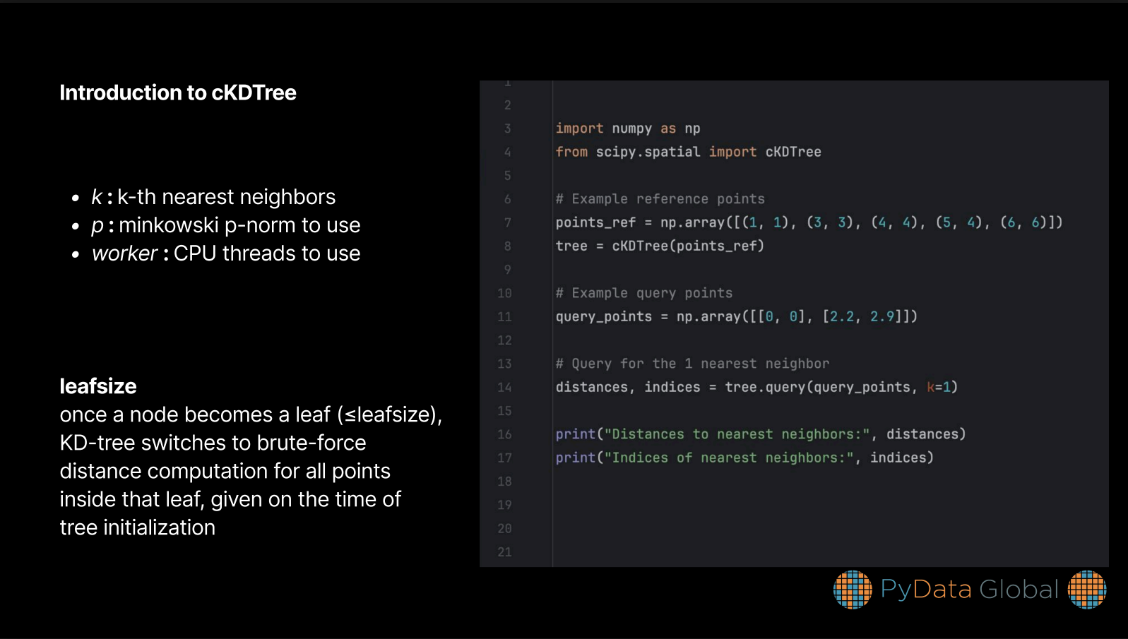
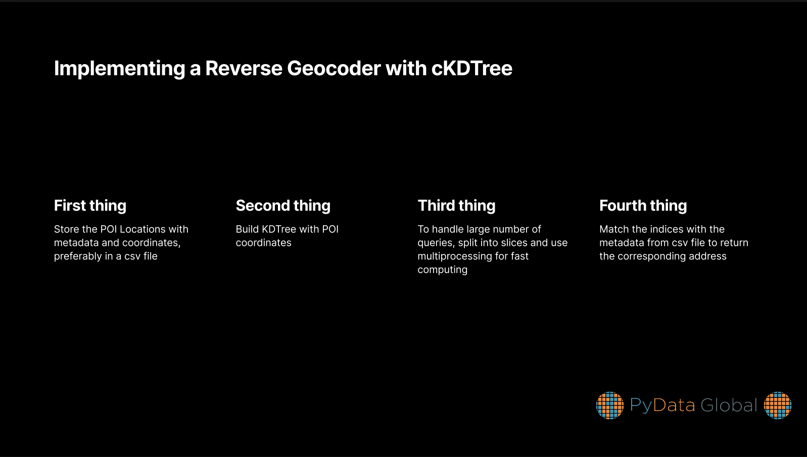


Demonstration of making a kDTree from scratch is shown inside jupyter-notebook/building_kdtree.ipynb file
But if you look closely, this method has a big drawback of accuracy, since the coordinates we build these are boundary independent, places close to boundary region would give wrong address
To solve this, the closest neighbours should be verified by their boundary
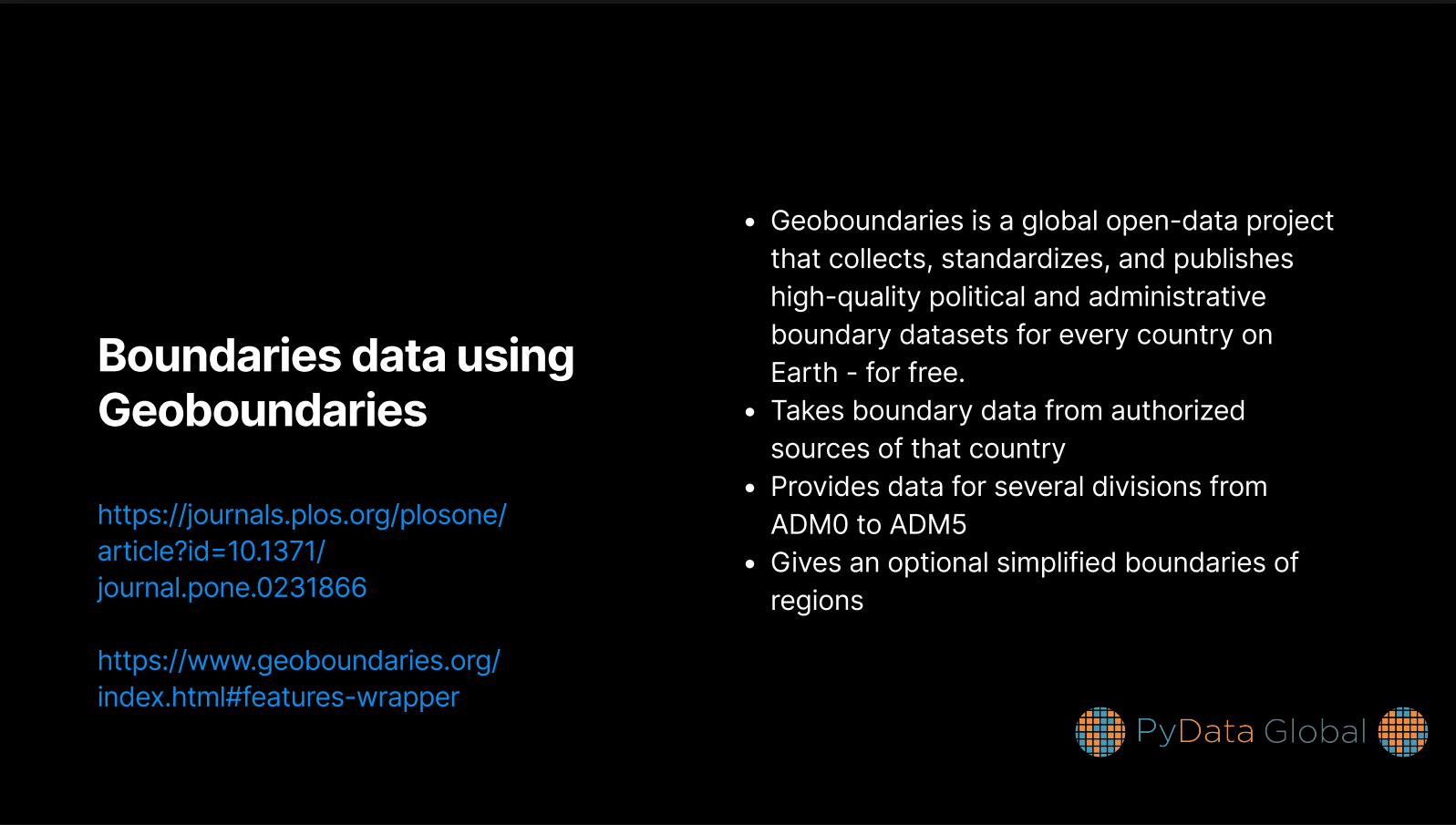
But here is another issue, you can’t store all the boundaries in the world inside a single python library, due to its sheer size
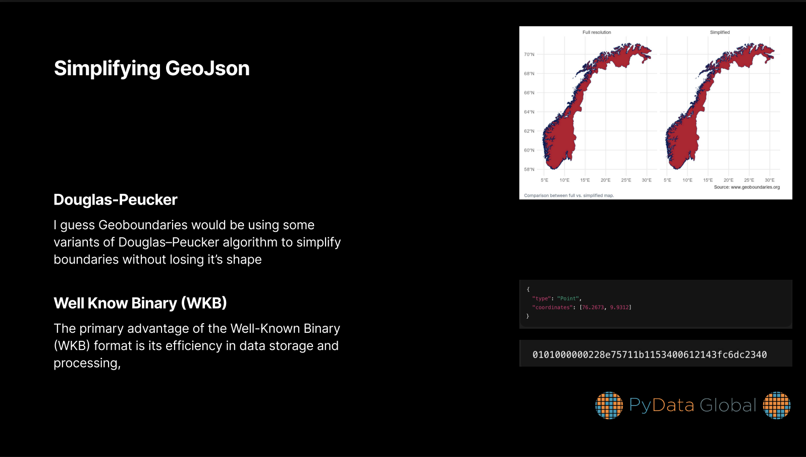
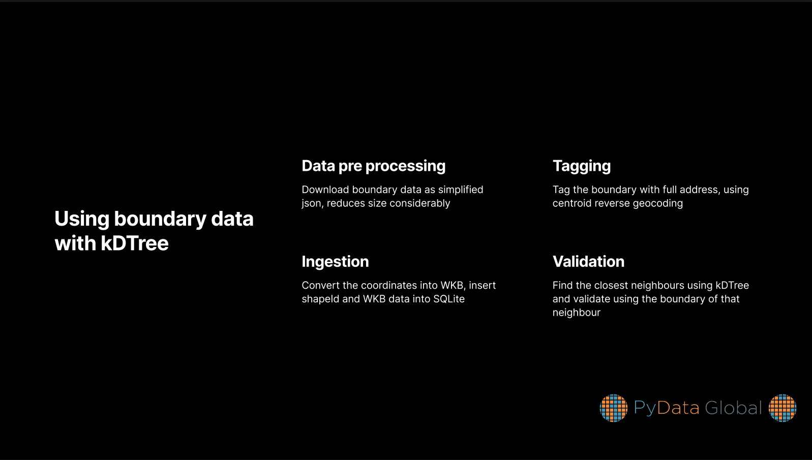
Thankfully I came across geoboundaries.org, they provide high quality data fully free and open source, as a cherry in the top, they provide simplified boundaries in geojson format.
I decided to store regions from ADM1-ADM3 which are essentialy States, Counties and Cities/Town. Instead of storing raw json or parquet for every region (around 140,000 files), I decided to store WKB(Well Known Binary) boundary coordinates and shapeId into a local sqlite file, and they would be converted on the fly of computation
By doing all this, I was able to store the boundary data in sqlite file with a size of 100MB
I have given a comparison between other libraries and mine inside jupyter-notebook/comparison.ipynb file and benchmark in the 10th slide
Feel free to ask about any doubts or suggestions you have, I have attached my contacts at the end of slides
Reflections
I think that building a reverse geocoder from scratch was a great learning experience. I got to know about various spatial data structures, spatial indexing techniques and geospatial libraries in python.
Also it can be used as a backbone for more sophisticated projects for advertising, logistics, mapping etc.
Citation
@online{bochman2025,
  author = {Bochman, Oren},
  title = {Designing a {Fast,} {Offline-Capable} {Reverse} {Geocoder} in
    {Python:} {An} {Open} {Source} {Alternative} to {Big} {Geo} {APIs}},
  date = {2025-12-09},
  url = {https://orenbochman.github.io/posts/2025/2025-12-09-pydata-reverse-geocoder/},
  langid = {en}
}